
![]() Geographic
Information Systems and Remote Sensing
Geographic
Information Systems and Remote Sensing
Geographic Information
Systems (GIS)
Geographic Information Systems (GIS)
are one of the most important developments to occur recently in Geography. You
can think of GIS as computerized mapping. Computers revolutionized our ability
to analyze large amounts of information about the Earth, and these improvements
have affected everything from how we study the environment, to how the government
works, to how large businesses operate.
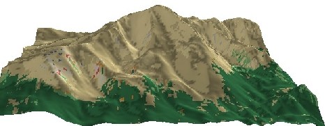
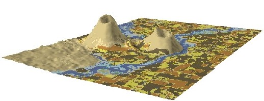
I teach a couple of classes in GIS, and the last two examples were made by some of my students in a lab exercise. Lucky for them, GIS is not hard to learn, and there are a lot of jobs out there for people who know how to use it.
Remote Sensing
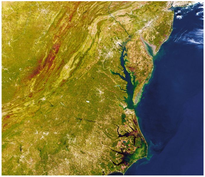
Remote Sensing is simply the ability to see the ground from far away. It is
a phrase we use that covers airplanes taking photos of the ground, and satellites
using sensors to create images of the Earth. There are lots of satellites recording
images of the Earth right now, and much of this imagery is available for free
on the Internet. Here are a few examples:
This last image is from a sensor
called ‘MODIS’- see if you can click on the city of Baltimore in
the image below.
Copyright
©2011 Martin Roberge. |